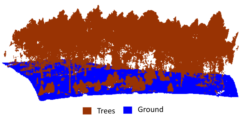
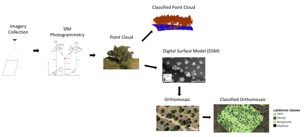
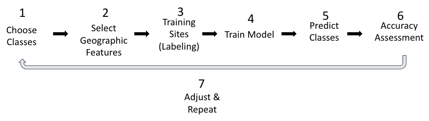
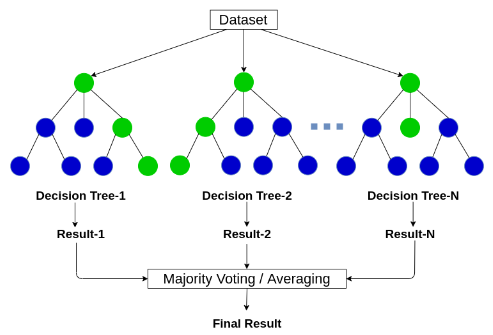
Classification
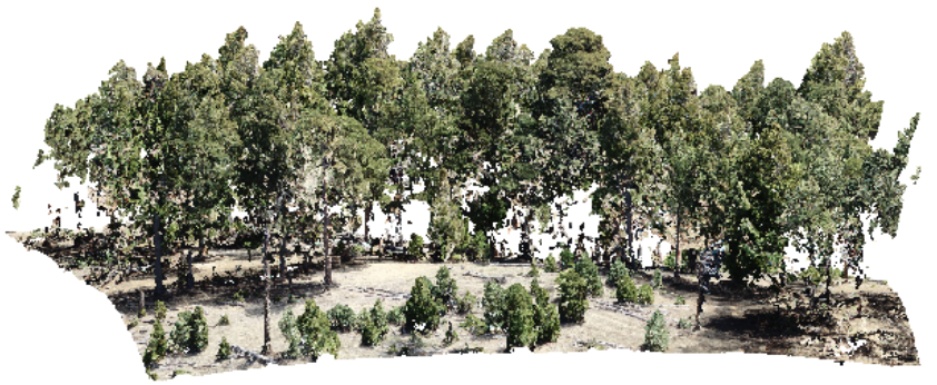
Photogrammetric Point Cloud
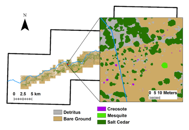
Remotely Sensed Changes in Vegetation Cover Distribution and Groundwater along the Lower Gila River
UAV in the advent of the twenties: Where we stand and what is next
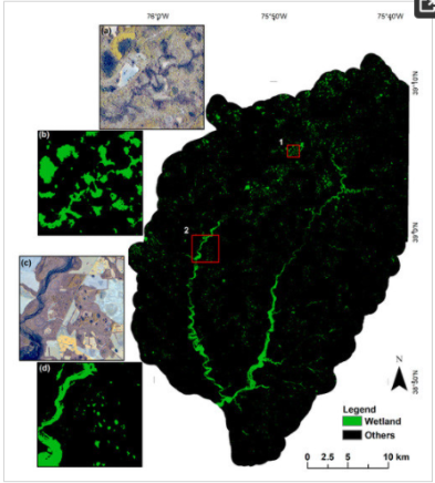
Mapping Forested Wetland Inundation in the Delmarva Peninsula, USA Using Deep Convolutional Neural Networks
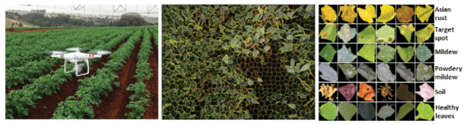
Automatic recognition of soybean leaf diseases using UAV images and deep convolutional neural networks
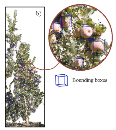
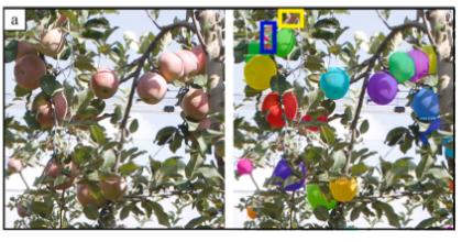
Fruit detection and 3D location using instance segmentation neural networks and structure-from-motion photogrammetry
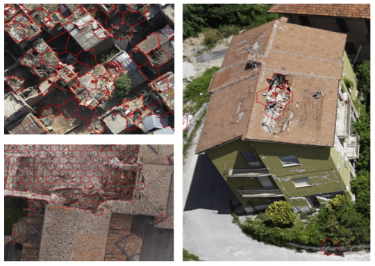
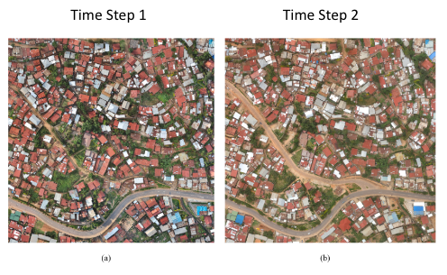
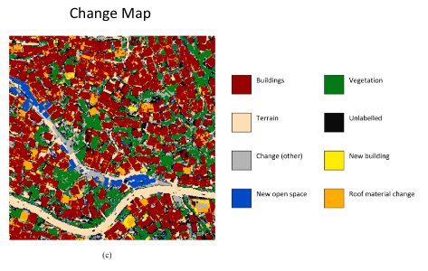
Disaster damage detection through synergistic use of deep learning and 3D point cloud features derived from very high resolution oblique aerial images, and multiple-kernel-learning
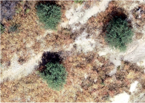
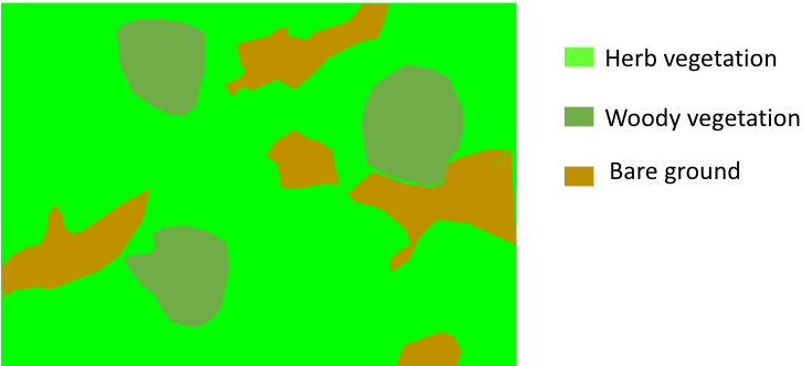
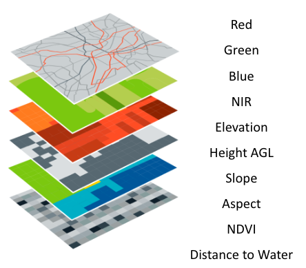
Semantic Segmentation
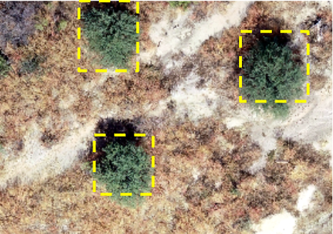
Object Detection
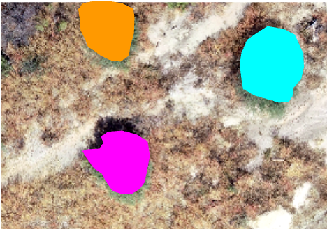
Instance Segmentation
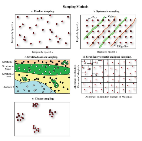
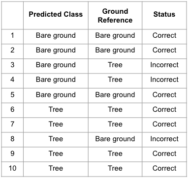
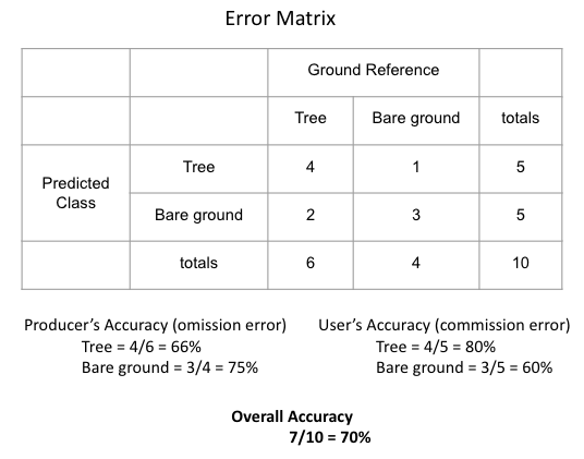
Jensen, J.R., 2016, Introductory Digital Image Processing: A Remote Sensing Perspective, Boston: Pearson Education, Inc., 623 p.
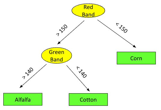
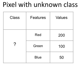
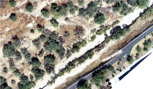
Pixels
Unclassified Objects

Last update:
2023-08-18